
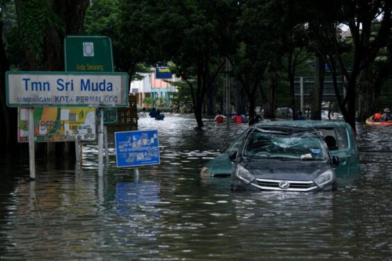
THE torrential downpour caused by Tropical Depression 29W throughout the peninsula for three days from December 17-19 caught many Malaysians by surprise. The ensuing flooding ravaged many low lying areas in Selangor and Pahang.
Videos circulated showed overflowing rivers, landslides, major roads being cut off, stranded motorists, homes, buildings and cars submerged , buried and some washed away as well as many residents rushing to higher grounds including roof tops to keep safe.
This deadliest tropical cyclone-related disaster to hit Malaysia has demonstrated that the nation was ill prepared to respond to this crisis. Global warming linked to extreme weather including worsening floods was among factors attributed to this climate crisis.
Public’s fury
Videos of many stranded on roof tops – suffering from cold and hunger with no immediate rescue from the Government – has sparked public anger regarding the Government’s response to this crisis.
Insufficient early warning of the torrential rain and uncoordinated/slow response in rescue and relief efforts by the relevant authorities were factors that contributed to the public’s fury.
Prime Minister Datuk Seri Ismail Sabri Yaakob explained that rescue teams had difficulties getting into Taman Sri Muda as floodwaters had risen rapidly while their rescue operations were also blocked by stranded vehicles.
As it is globally recognised that probability of finding survivors is highest within the immediate 72 hours following a disaster, the slow rescue and relief efforts had caused grave concerns that the death toll and damages to properties would further escalate.
As floods become more severe and more frequent, government at district, state and national levels must embrace and invest in advanced technologies which are revolutionising disaster management efforts.
One of the many challenges of responding to a natural disaster is the difficulty to determine the location and extent of damage including whereabouts of victims to effectively mobilise rescue and relief efforts.
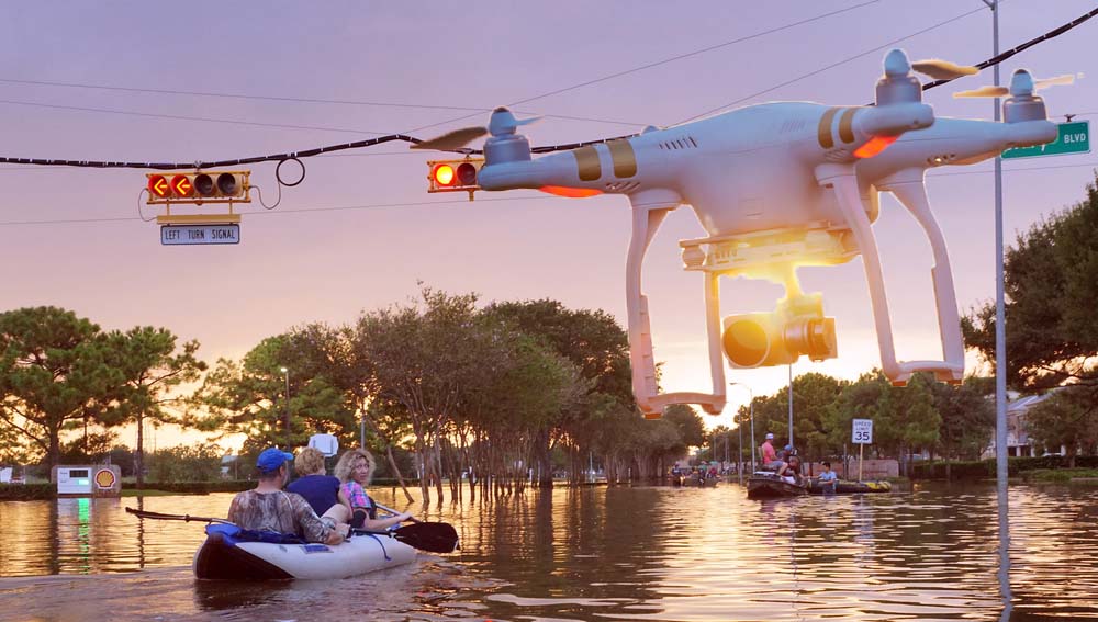
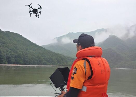
In this regard, the drone technology can be used to pinpoint the location of victims, damaged sites, buildings, floodplains, emergency service resources and disaster relief sites.
Unmanned aerial vehicles (UAVs) and underwater unmanned underwater vehicles (UUV) a.k.a drones are being used worldwide for a myriad of applications including aerial photography, agricultural monitoring, infrastructure inspection, construction, media production as well as in research and development efforts.
Drones for disaster management
The Asian Development Bank had outlined that improvements in materials and electronic control systems have provided increasing drone range along with the ability to attach high-resolution digital cameras, advanced global positioning technologies, and sophisticated computing power.
UAVs with various types of on-board sensors and advanced computer technologies are able to fly in life-threatening condition and at low altitudes.
Images from drones that are of higher resolution than satellites are fast becoming useful tool for large-scaled aerial mapping while underwater drones can facilitate efforts in examining infrastructure and coordinating rescue efforts in heavily flooded areas.
In tandem with these developments, new regulations and policies have been introduced by several countries worldwide for the use of drones for commercial, non-hobby purposes including its use by first responders as part of disaster response and assessment operations.
A number of countries have incorporated drones into their national emergency and disaster management operations, including the US in 2005 to search for Hurricane Katrina survivors in Mississippi and India during the Uttarakhand floods of 2015.
Drones were also used by Puerto Rico during Hurricane Maria in 2017 which had devastated the nation and by Mozambique in 2019 during Cyclone Idai which caused severe flooding in the region.
In November 2021, the US Federal Aviation Administration (FAA) had approved AT&T’s request to use a new drone known as the Flying Cow or Cell on Wings to help restore cellular service in Puerto Rico.
The Pulse Vapor 55 drone which flies 200 feet above the ground – and able to cover an area of 40 sq miles – functions like a cell tower in the sky, providing voice, data and internet services.
Mozambique had used drone imagery to localise stranded communities in areas that are inaccessible by road transport. This information was used to improve the routing of the rescue boats for food supply and evacuation.
The Korean experience
Trilateral Best Practices: Application of Technology for Reducing Disaster Risks in China, Japan and South Korea July 2021 had showcased South Korea’s Public-private partnership emergency drone operation team for disaster response.
It shared that since South Korea introduced drones as part of its disaster investigation equipment in 2013, the National Disaster Management Research Institute of its Interior and Safety Ministry has been using drones to investigate damages caused by typhoons and torrential rains to enhance national disaster management capabilities.
The government and private sector became partners for national disaster management, creating the “Emergency Drone Operation Team for Disaster Response” composed of individual drone owners who hold official drone qualifications.
The emergency drone operation team serves as an exemplar of citizen participation and cooperation as it involves individual drone operators’ donating their talent for national disaster management.
The team aims to strengthen region-based disaster response capabilities by maintaining great interaction with government agencies, including police stations, fire stations, and local governments.
As disaster management paradigm is shifting toward greater public-private partnership, citizens and the government should work together closely, particularly in instances when it is difficult to resolve a situation using only government-led manpower and equipment.
The report dovetailed that the active participation of the private sector in the disaster response process is not an option but a necessity in the governance of disaster management.
Recommendations for Malaysia
As drones are fast becoming standard operation in many emergency situations due to their unique features, it is recommended that the Government adopt this international best practice to enhance national emergency and disaster management aimed at saving lives as well as protect and reducing damages to infrastructure and properties.
Given that Malaysia has a number drone specialists, the Government could develop a directory of these specialists to invite and engage them to support in the nation’s disaster management.
A number of drone suppliers are already providing services in several aspects of the economy in Malaysia. The Government could invite these companies to deliver a presentation on their products and services to identify their suitability as partner in Malaysia’s disaster management efforts.
As the Malaysian Communications and Multimedia Commission (MCMC) and Malaysia Digital Economy Corporation (MDEC) have portfolios on drone policies and regulations, they should be invited by the Government to discuss new policies and regulations that may be needed to support and facilitate usage of drones for rescue operations.
Moreover, disaster management experts from the National Disaster Management Agency (NADMA), police and armed forces could identify a select number of personnel to undergo training on drone operation to enhance their skills in this technology with the aim to further strengthen Malaysia’s emergency and disaster skills, competency, efforts and management.
Sheriffah Noor Khamseah Al-Idid Syed Ahmad is a former special officer to Malaysia’s first Science Advisor to the Prime Minister Innovation & Nuclear Advocate Alumna, Imperial College, University of London, UK.
The views expressed are solely of the author and do not necessarily reflect those of Focus Malaysia.
Main pic credit: Bold Business